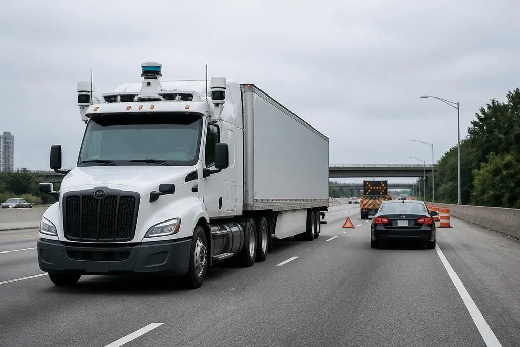
An autonomous truck must spot a stopped car, hold its lane, and reach a safe stop when a sensor fails. The biggest gains in this field have come from the systems that handle those jobs together, rather than from one new part.
This matters to a fleet manager because a truck that drives well in a test area may still need help at a depot gate, roadworks site, or busy highway merge.
Quick read
- Cameras, radar, and LiDAR give the truck different views of the same road.
- High-definition maps help with lane shape, but the truck still needs live sensing.
- Remote support and safe-stop systems decide what happens when the software meets a case it cannot handle.
Sensing that covers the road
Cameras read lane markings, traffic lights, signs, and vehicle shapes. Radar measures distance and closing speed, which helps the truck judge a vehicle that is moving toward it through rain or darkness. LiDAR sends laser pulses and builds a 3D view of nearby objects.
Each sensor has a weak spot. A camera can lose clear detail in glare, radar can have trouble describing an object’s exact shape, and LiDAR can return less useful data in heavy rain or dust. Using several sensor types gives the driving system separate measurements to compare.
The gain is practical. If one view looks wrong, the truck has another way to check the same object before it changes speed or position. That does not remove every error, but it gives the control software more information than a single camera system.
Maps that support, rather than replace, live data
Autonomous trucks can use high-definition maps that record lane lines, road edges, signs, slopes, and fixed objects. A map can tell the truck that a lane bends after a bridge, even when paint is worn or the road surface is hard to read.
Maps have a limit: roads change. Construction barriers move, lanes close, and a parked vehicle can block the route. The truck must compare the map with current sensor data, then follow the road that exists now.
That split between stored detail and live sensing is one of the field’s useful advances. It lets the truck plan ahead without treating an old map as a command. Coverage also matters, since a route outside the mapped area may need a different operating plan.
A mapped route shows where the truck has been tested; it says less about a stalled car or fallen load. For dated tests, see Robot24.com’s road-test reporting. The next section looks at what happens when the road presents something the system has not seen before.
Better handling of unusual road events
A highway run can look easy until a tire lies in the lane, a police vehicle blocks the shoulder, or a worker waves traffic through a temporary gap. The driving system must detect the object, work out which traffic rules apply, and choose a safe action with limited time.
This work depends on prediction. The software estimates where nearby vehicles may move, then checks whether its planned path leaves enough space. A truck also needs a clear rule for uncertainty: slow down, stop, or ask for help.
Remote support fits into that gap. A person can review a situation and send guidance, while the truck remains responsible for control and braking. The open issue is response time and network coverage, since a remote operator cannot replace onboard safety systems during a weak connection.
Safe stops and fleet operations
A useful autonomous truck needs more than highway control. It needs fault checks, a way to pull over, a remote link, and a process for restarting after a stop.
Those systems turn a sensor fault or blocked route into a managed event instead of an uncontrolled one. The operating area matters too, because a route with clear lane markings and fixed entrances is easier to manage than a depot shared by people, forklifts, trailers, and changing loads.
Loading, coupling, inspections, and roadside repairs still need people unless the full workflow has been designed around the truck.
I’d judge an autonomous trucking system by how often it reaches a safe state without help, not by its smoothest highway video.
A buying checklist for fleets
Before a pilot, check the following:
- Route limits: list the roads, weather conditions, depots, and handoff points the system supports.
- Fallback plan: record what the truck does after a blocked lane, sensor fault, or lost connection.
- Human support: ask who responds, what they can change, and how the truck stays safe while waiting.
- Map updates: set a process for roadwork, lane changes, new entrances, and map errors.
- Maintenance load: count sensor cleaning, calibration, software updates, and roadside checks.
- Success measure: track completed trips, safe stops, remote requests, and reasons for each intervention.
These checks put the useful question in the right place: can the truck finish the route under the conditions your fleet actually faces?
The next step is proof that sensing, planning, remote support, and safe stops work as one system on a defined route. Another sensor has limited value if the truck still cannot reach a safe state when conditions change.